

During the recent global summit on biodiversity, world leaders committed to protecting 30% of the world’s oceans for nature. But which 30% of the oceans should be protected to safeguard the most vulnerable biodiversity? This question has beset ocean conservationists for decades because oftentimes, protected areas are established in places with few competing interests, rather than where they will benefit biodiversity the most.

Tristan Albatross near Gough Island, South Atlantic. These albatrosses now benefit from one of the largest marine conservation zones around their breeding island. Photo credit: Steffen Oppel.
Tracking seabirds using electronic devices, like geolocators or GPS loggers, to identify where they find their food, is one way to identify areas of high biodiversity value at sea. For the past two decades, scientists at BirdLife International and the RSPB have collaborated with researchers across the world, making it possible to collate movement information on more than >150 seabird species. Many of these tracking data have since been used to identify key areas where birds find food at sea, which may need formal protection. For example, in 2022, the first protected area in the high seas was declared, after tracking data revealed the importance of a large area in the North Atlantic to several seabird species.
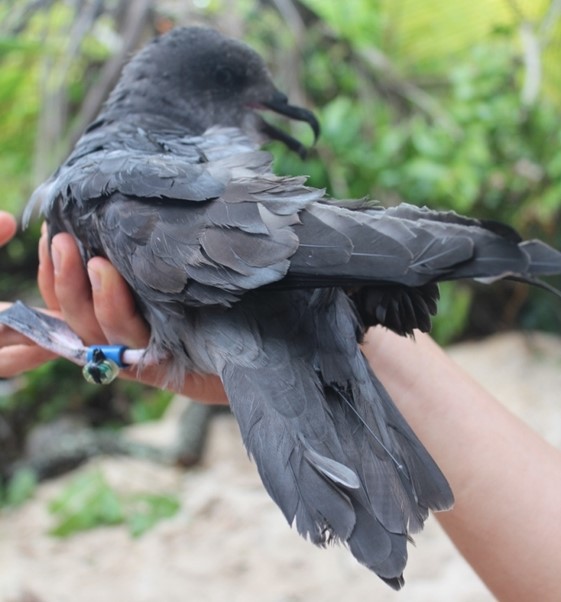
Murphy’s Petrel equipped with a geolocator and GPS logger on Henderson Island, South Pacific. These birds nest on such remote islands that it is very difficult for researchers to track them in multiple years. Photo credit: Steffen Oppel.
One persistent problem with using tracking data is knowing how much is ‘enough’ to identify sites of importance for wildlife. This is akin to asking five friends what they do over the summer holidays, and then concluding that the entire human population will do the same. Most likely, they won’t – you would need a much larger sample size to adequately understand where the ‘population’ of people will be over the summer holidays. Then, once you have figured this out for one summer, the next question arises of whether people will do the same thing every year?
A new study led by BirdLife International attempts to answer these questions, by quantifying the importance of tracking more individual birds vs. spreading effort across years when characterising the spatial distribution of seabirds. The researchers compiled data from 23 seabird species, during the time of the year when breeding birds are foraging at sea to feed their chicks in the nest. For each species, the data were collected in no less than four different years, with at least 10 birds tracked each year – a huge amount of effort for each species! Based on this very rich dataset, the at-sea whereabouts of the birds were estimated in each year, and compared with all other years to understand how consistent the birds were in where they chose to look for food.
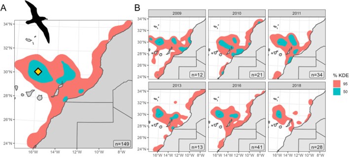
Marine foraging distribution of Cory’s Shearwater from Selvagem Grande Island, Portugal, during the chick-rearing period. These shearwaters used very similar areas at sea in all of the years they were tracked.
The research team found that the estimated pattern of space use at sea was mostly dependent on how many individuals had been tracked – just like you would need to ask at least 500 people for their summer holiday plans before being able to draw any meaningful conclusions about a human population. So once enough individuals had been tracked, the effect of tracking birds in different years was relatively minor. Although there were important exceptions in years with strong environmental anomalies, most of the seabirds studied used similar areas year after year to find the food for their chicks.
This behavioural consistency across years is good news for advancing the protection of seabirds nesting on remote oceanic islands: so far, the global standard used to identify important sites for biodiversity – the Key Biodiversity Area standard – requires that the importance of an area be demonstrated with at least three years of data. However, given the results of this study it may become possible to identify Key Biodiversity Areas based on representative data even if they were collected in fewer years. As long as sufficient individuals have been tracked to determine the spatial distribution of a population – because not all birds of a feather necessarily flock together.
