

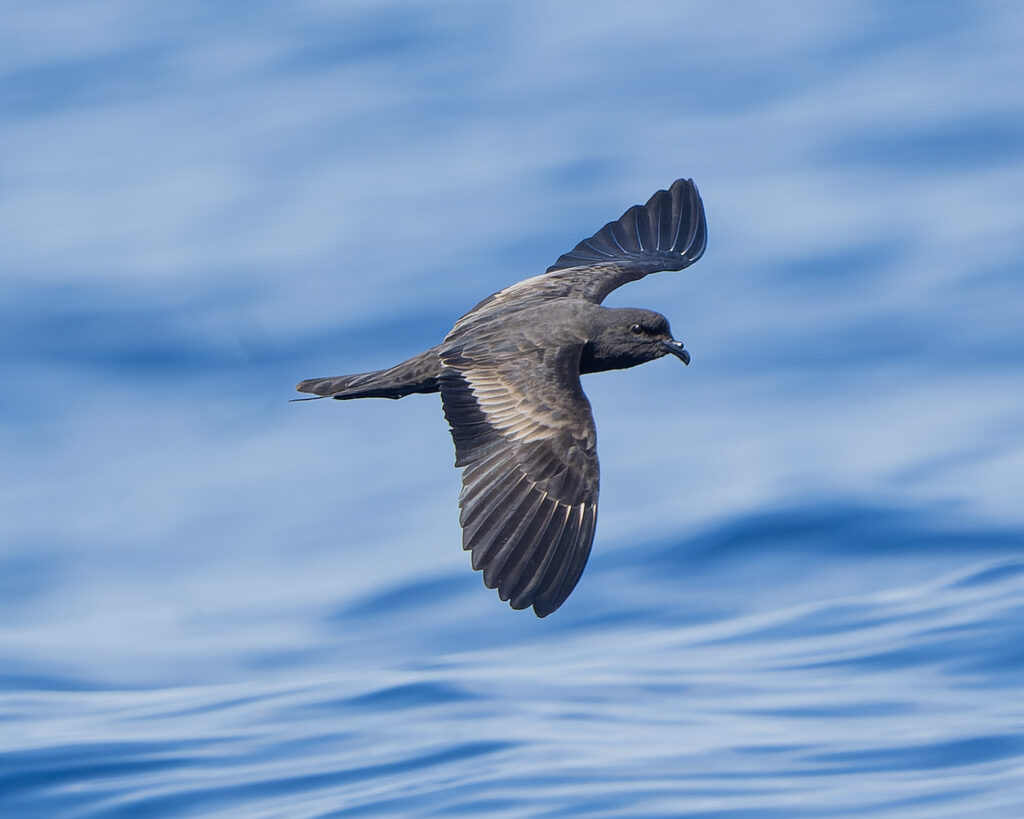
Far from land, across the waters of the Gulf of California, a small black seabird makes journeys that are almost impossible for humans to observe, even locals have never seen them. The Black Storm-petrel (Hydrobates melania) spends the day at sea and returns to its breeding colony under the cover of darkness. Its secretive behavior, remote nesting sites, and small body size have made it one of the more challenging seabirds to study.
Now, we have taken an important first step toward revealing what happens during those unseen journeys. In a new study published in Marine Ornithology, researchers from Mexico and Italy report the first successful GPS tracking of a Black Storm-petrel. The work was conducted at Los Islotes, within the Espiritu Santo Archipelago National Park in Baja California Sur, Mexico. The study provides a first glimpse into how this elusive species travels across the marine environment while nesting.
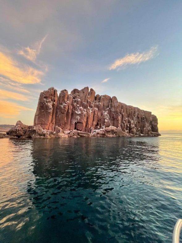
Study site: La Lobera, Espiritu Santo National Park, northernmost islet. Photo by Daniel Aguirre Ayala
The challenge was considerable, and not only because of the bird’s size, as the Black Storm-petrels weigh around 60 grams. The team also faced two additional hurdles: accessing the nests themselves, which are located in rugged, hard-to-reach areas, and to recover the GPS unit. Since the birds only return to their nest at night, we had to locate and retrieve the device in darkness, while taking care not to disturb the colony.To make things even more challenging, the colony is also home to more than 900 California sea lions! Against this challenging backdrop, we fitted an adult bird with a nanoFix mini-GPS weighing just 0.96 grams—less than 3% of the bird’s body mass. The device recorded the bird’s position once every hour.
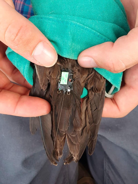
The tracked Black Storm-petrel with GPS. Photo by María Alejandra García Castro
The resulting journey was remarkable. Although only a partial track was recovered , the bird accumulated 181.58 kilometres of travel over 16 hours and reached a maximum distance of 110.85 kilometres from its colony. Its average ground speed was 3.15 metres per second, while its maximum recorded speed reached 7.9 metres per second. That is an average speed of 11.3 kph; incredible for such a small bird.
But distance was only part of the story. We were particularly interested in the relationship between the bird’s movements and the wind. The Black Storm-petrel initially traveled northeast across the Gulf of California. As wind conditions changed, the bird altered its flight direction. Its movements appeared to take advantage of crosswinds and, at times, tailwinds, suggesting that it may navigate through favorable atmospheric conditions to make its flights more efficient. In other words, the wind may act like an invisible network of highways across the sea.
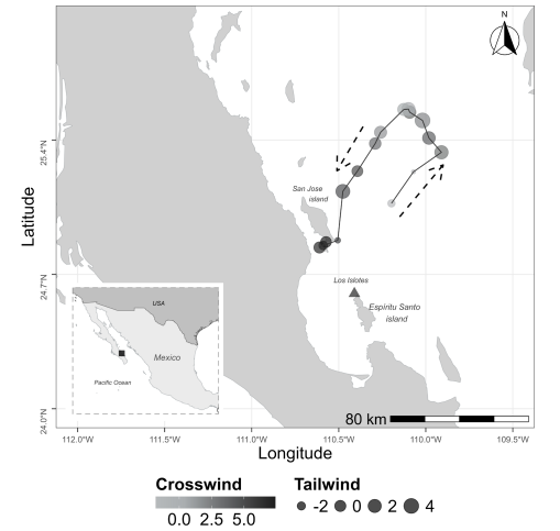
Flight path of the GPS tracked Black Storm Petrel. Travel direction (dashed arrows) and wind influence shown (greyscale gradient represents crosswind intensity (m.s-1), dot size indicates tailwind intensity (m.s-1)). Los Islotes (Baja California Sur, Mexico) colony marked with triangle. Figure 2 from Cristerna et al. (2026)
This study also provides encouraging evidence that this type of tracking can be done without notorious harm to the birds. When the GPS was recovered, the individual’s body mass was the same as before deployment—64.1 grams. The bird had also continued breeding successfully, eventually fledging its chick. This was only one bird and only a partial journey, so the findings are preliminary. Nevertheless, the achievement is significant: there had previously been no published GPS tracking data for the Black Storm-petrel.
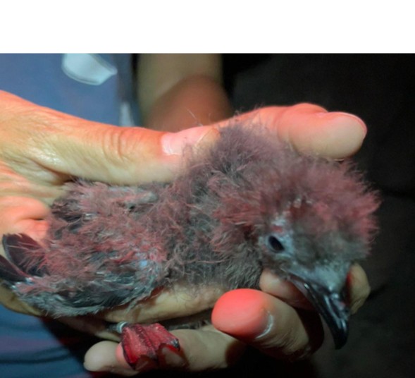
The offspring of the tracked Black Storm-petrel. Photo by Gemma Abaunza
By combining miniature technology with fieldwork in one of Mexico’s most important marine protected areas, we opened a new window onto the hidden life of this elusive seabird. Future tracking studies could reveal where Black Storm-petrels feed, how they use wind and ocean conditions, and which marine areas are especially important for their survival. Sometimes, understanding a species begins with simply following where it flies.
Read the full paper here: Cristerna, J., Abaunza, G., López-Hernández, J. A., Soldatini, C., Albores-Barajas, Y. V., De Pascalis, F., & Cecere, J. G. (2026). First GPS tracking of the Black Storm Petrel Hydrobates melania. Marine Ornithology, 54(1), 125-130.
http://doi.org/10.5038/2074-1235.54.1.1681
Data available to request on the Seabird Tracking Database, dataset ID: 2666